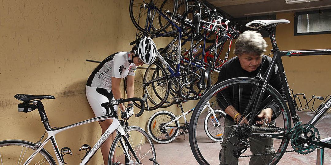
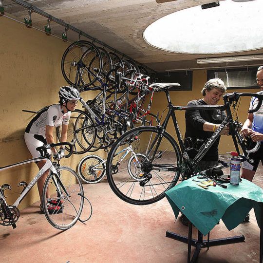
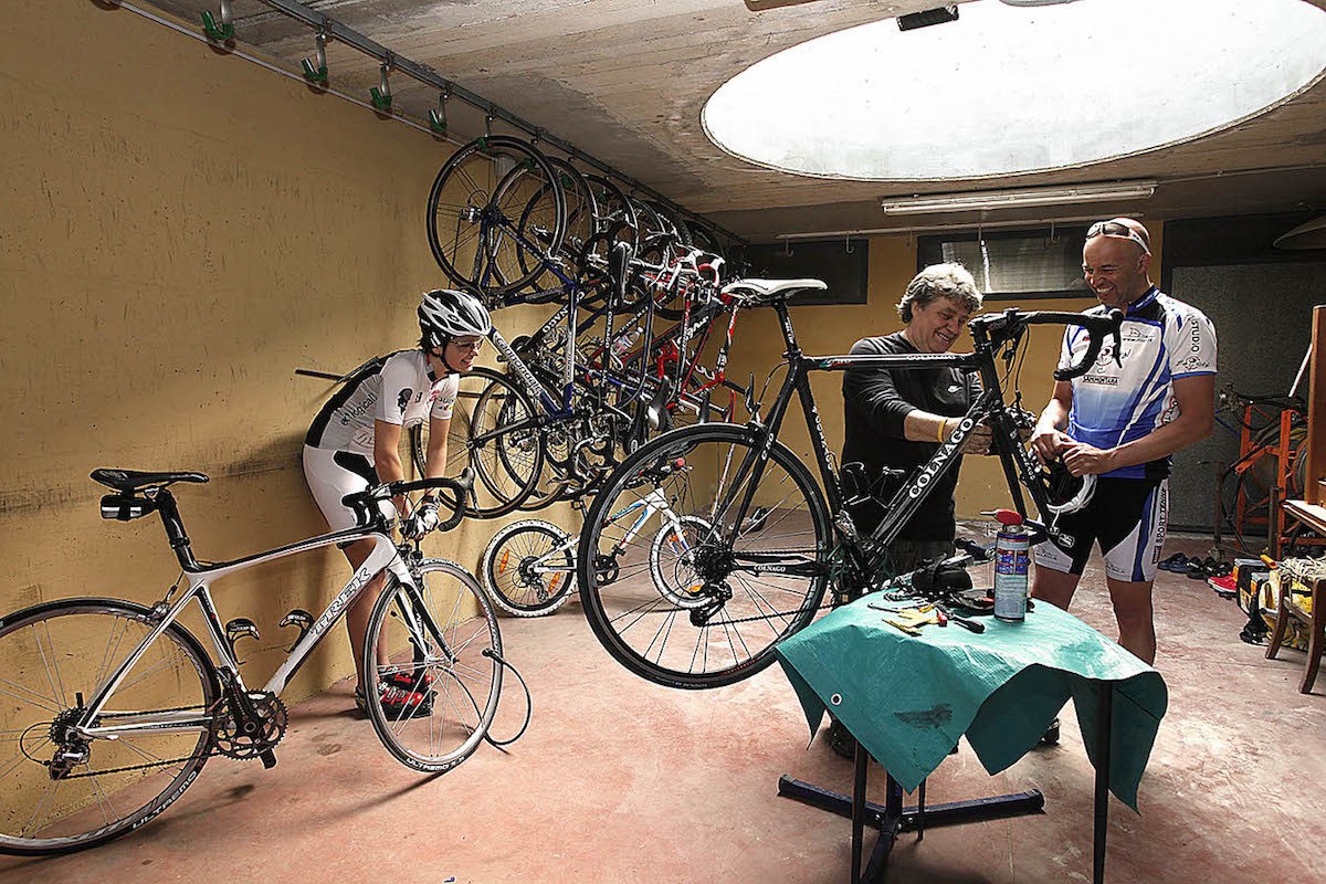
Tuscany Bike Tours
The village of Bolgheri is one of the most attractive in Tuscany. Although it has extremely ancient origins, its current development is linked to the history of the Gherardesca Counts who gave a great boost to the village from the XVIII century. In the shade of the alleyways, we can go in search of the house where the poet Carducci lived, and by bike we can explore the fertile countryside below, obviously riding along the famous avenue of Cypress trees and through the wonderful background of the vineyards that are the pride and joy of Italian wine production. The cycle route we are suggesting is easy and will take you through the famous vineyards and olive groves. We are going to discover this wonderful area, starting from the castle of the Gherardesca Counts of Bolgheri, near Piazza Santa Teresa and the church of Saints Giacomo and Cristoforo, the oldest in the area. In front of us there is the descent down one of the most famous avenues in the whole of Italy, that avenue of Cypress trees that the poet Carducci immortalised in Rime nuove. At that time, the newly-planted Cypress trees were still small, but now form a majestic row that accompanies the visitor for more than four kilometres as far as the gates of Bolgheri and from there to provincial highway no. 39. During this route we will find some turn-offs along the road, for Bibbona first of all and then Castagneto. We go straight on through the vineyards. We are in one of the most prestigious wine-growing areas of Tuscany, with its unique climatic and soil characteristics, that foster the production of very complex wines. This is why the Bolgheri area has been called the Eldorado of Italian wine. When we arrive at the end of the avenue, at San Guido, where we find, on one side, the Consortium “Strade del Vino Costa degli Etruschi” and on the other the Sassicaia estate, we arrive at a halt sign. We proceed towards the north, passing the new Aurelia road and running parallel with the railway, without turning off, until we enter the municipality of Bibbona. Here we find a junction on the right, among cypress and pine trees, where we follow the signs for the village, riding through the Bibbona countryside. This countryside is also fertile and rich in products, especially after the reclamation works during the Leopoldian period of the eighteenth century. We pedal on, literarily surrounded by the olive groves that cover every hillside, while the excellence of the local wine production is confirmed by the DOC “Terratico di Bibbona”. We continue through this beautiful environment until we reach the junction for Bibbona which deserves a visit to see its characteristic little streets in the centre and the parish church of San Ilario that dates back to the XI century. We continue along our route that goes up and down along the hillsides. This is the most attractive part of the route that heads south, passing through many farms. On our left we see the gentle hills of the hinterland while to the west we can see the coast and the sea. Once again it is the tops of the Cypress trees along the avenue we took on our way out that indicate the direction we must take. After seeing Bolgheri appear among the hills we soon arrive at a turn-off, among holm-oaks and pines, which we saw on our outward journey. We turn left and after a slight climb we enter the village through the gate we took as we left.
Point of departure/arrival: Donoratico The path goes through olive groves to a big pinewood, where your turn right onto a wide dirt road, Viale dei Cavalleggeri, as far as the asphalt road (opposite the Cavallino Matto amusement park). Turn left, skirting the amusement park, along the road towards the sea as far as the Via della Colonia turn off on the right (reference: a reinforced concrete bar-restaurant with a very steep roof). At the T-junction at the end of the road (Tombolo hotel with yellow walls), turn left towards the sea and once on the seafront go right, passing Shangri-là and Tana del Pirata bathing beaches. Carry on along the asphalt road past the Alle Dune hotel (on the right). After a while the road turns inland through the pinewood (Via del Dentice), coming out near Lo Sperone riding stable. At the next intersection, carry straight on as far as Viale delle Palme, where we recommend you turn left towards the mouth of the Seggio river (1.3km), an ideal spot to watch the sunset. Turn back along Viale delle Palme as far as the Bar King where you turn right towards Il Cavallino Matto amusement park. Take Viale dei Cavalleggeri through the pinewood again and return to the departure point on the same cycle path as before.
Point of arrival/departure: Donoratico The most challenging parts are the uphill climbs to Sassetta and Campiglia Marittima. A stop at the medieval hill town of Suvereto is recommended. Hotel Bike Tuscany sea Depart from Donoratico on the Old Aurelia towards Cecina. After approx. 1km, at Il Bambolo, turn right onto SP329 towards Castagneto Carducci. The road rises gently for 3km as far as the hamlet of San Giusto, where the easily pedalled 2.5km climb to Castagneto Carducci begins (6.8km). After the village, the road enters a wood and winds towards Ponte d’Oro where an approx. 2km climb to the Bocca di Valle pass (12km) begins. At a prominent left-hand bend, turn right towards Sassetta (13.8km), which is reached after going through Le Fornaci. After crossing the town, carry on for about 1km up a gentle incline and from there it is an enjoyable downhill ride towards Val di Cornia. The road is perfect from a cyclist’s point of view – there is little traffic and it is technically challenging with plenty of bends. A wide bend to the left leads past the Annunziata spring and the ruins of the church of the same name. The road then runs through scrubland as far as Prata where the wide, sunny Val di Cornia opens out before you. A short rise, and then down again in a flurry of bends through the olive groves to the village of Suvereto (27.1km). The road skirts the historic centre. Before leaving the village, turn left onto SP398 (do not go straight towards CafaggioVenturina), downhill towards Monteverdi and Monterotondo, passing “La Bulichella” holiday farm. Cross the bridge over the Fosso di Gore, and about 3km from Suvereto there is an intersection (30.4km); leave SP398 which turns left here and carry straight on, following the signs for Massa Marittima and Montioni on the “Montioni” road (SP19). Cross the bridge over the River Cornia, turn right at the fork and take the ”San Lorenzo – Banditelle” road (SP22). After approximately 1.3km, go through the hamlet of San Lorenzo, past vineyards and the Petra wine cellar and after a short, easy climb, skirt the Casalappi farm. A short descent and a sharp bend to the left lead to a crossroads (39km). Here you are 4.5km from SP22. Leave the provincial road and carry straight on for 2km to a crossroads where you go left, following the high tension lines to the next T-junction where you turn right onto the “Campiglia Marittima – Riotorto” road (SP21) towards nearby Cafaggio (43.2km). From here, follow the signs for Campiglia Marittima (about 4km uphill); the road steepens almost immediately, and after several twists and turns, comes to a T-junction. Continue right, still uphill, towards Campiglia Marittima (47.7km). From the town it is a fast downhill ride (about 6km) to the Aurelia (SS1) underpass. At the Old Aurelia (SP39), turn right to arrive shortly at San Vincenzo (57.2km) and then Donoratico (63.5km).
Point of departure/arrival: Donoratico The most difficult stretches on the route are the climbs up to Serrazzano (short but steep), Volterra and Montecatini Val di Cecina. The villages of Castagneto Carducci and Bolgheri, which are in the area of the departure/arrival point, are well worth a visit. All the towns and villages crossed by the itinerary are worth a stop, especially Volterra. Hotel Bike Tuscany sea Departure is from Donoratico on the Old Aurelia towards Cecina. After about 1km at Il Bambolo, turn right towards Castagneto Carducci on the “Bocca di Valle” (SP329). The road rises slightly for 3km to San Giusto where the easily pedalled 2.5km rise to Castagneto Carducci begins (6.8km) Beyond the village, the road enters a wood and winds towards Ponte d’Oro where a rise of about 2km to the Bocca di Valle pass begins (12km). At a very evident left bend, follow the signs for Monteverdi Marittimo, staying on SP329 and ignoring the turn off for Sassetta. A final uphill burst, and then an easy, pleasant ride up and down for about 9km to Monteverdi Marittimo (22km). Staying on the main road, start the lovely 3km descent to Canneto (26.5km). Just before the village, the road starts to rise again. Before entering the village, turn right at the intersection and follow the signs for Serrazzano. The climb can be pedalled but does require some effort. After about 4km you reach the ridge of the metal-bearing hills with views ranging over the Val di Cornia (on your right) and Monterufoli forest (on the left). The ridge road continues to rise and descend, and beyond the turn off for Lustignano (32.5km) begins to rise towards Serrazzano (32.5km). For the first 2km the going consists of demanding twists and turns, while the last kilometre is an 11% incline leading to the centre of Serrazzano village. It is then downhill towards the boric-acid fumaroles in the Valle del Diavolo (Devil’s Valley) and the junction with SR439 (44.5km) where you turn left for Pomarance. The road is wide and all downhill before it climbs up to Montecerboli (46.6km) with its panoramic view of Larderello and the Devil’s Valley, where the National Energy Board plant produces geothermal power. The descent to the Val di Cecina begins here. The lovely, scenic road runs mostly downhill for 9km to Pomarance (56km) where, following the signs for Volterra, you continue to descend into the wide Cecina valley. After 13km you reach Saline di Volterra (69km). Here you turn right for Volterra, cycling the spectacular (and fairly busy) road that winds through ridges and gulleys caused by erosion as it climbs up to the “city of alabaster” (78km). The last 2km are extremely challenging. Before reaching the city walls, the route turns left downhill on the equally spectacular Monte Volterrano road (SP16), which descends steeply towards Val d’Era, and joins SR439 after about 9km (87.3km). Here you turn right, and after little more than 1km, go left onto SP32, which climbs fairly steeply up to Montecatini Val di Cecina. After 2km the climb becomes exacting; continue in “bursts” for 2.5km to the centre of Montecatini Val di Cecina (93.2km). After crossing the town, turn left for Ponteginori, going downhill for 8km on a demanding road that twists and turns through the vineyards of Buriano to the intersection with SR68 (101.7km), where you turn right. After about 2km, you reach Ponteginori (103.5km) and leave the busy “Volterrana” to turn left towards Micciano and Querceto on the “Camminata” SP19. Going over the railway crossing and the bridge on the Cecina river, carry straight on as the road rises and falls towards Casale Marittimo. After approximately 9km you meet the Sterza valley bottom road (112km) and carry straight on for Casale Marittimo. Cycle on the flat for about 2km, pass over the Sterza bridge, and then begin the climb to Casale Marittimo. There is a steep 1.2km incline as far as the turn off where you continue on SP19 towards Bibbona, still riding uphill for a short while before beginning the downhill descent. On the right is the hill-town of Casale Marittimo, on the left the beautiful Macchia della Magona (Magona Scrub), a magnificent wooded area inland from the village of Bibbona. It is a mostly downhill 3km ride to Bibbona (121.5km). At the (unmistakable) big intersection, leave the main road and turn left towards Bolgheri. After an initial demanding but short climb uphill, you reach a T-junction. Turn left onto the lovely Bolgheri Road, which runs for 5km through vineyards and olive groves in a total of 4 uphill/downhill stretches, to the famous cypress avenue at Bolgheri. After a visit to the little village (127.5km), follow the road downhill along the cypress avenue (about 1.8km) to the left turn for Castagneto Carducci. Ride for 9km among centuries-old oak trees to San Giusto (138.5km), turning right at the T-junction for Donoratico (142km).
Point of departure/arrival: Donoratico The most demanding parts are the uphill climbs to Castagneto Carducci, Bocca di Valle, and Casale Marittimo. Possible extension: Having reached La Gabella, make a detour to the hill town of Sassa, magnificently positioned overlooking the Sterza valley and the Metaliferous hills. Distance to the town is 6km, almost all uphill (a rise of 290m) with bends. Return to La Gabella on the same road. With this detour, the distance increases to 86.5km and the elevation gain to 1,050m. Depart from Donoratico on the Old Aurelia towards Cecina. After approx. 1km, at Il Bambolo, turn right onto SP329 towards Castagneto Carducci. The road rises gently for 3km as far as the hamlet of San Giusto, where the easily pedalled 2.5km climb to Castagneto Carducci begins (6.8km). After the village, the road enters a wood and winds towards Ponte d’Oro and the start of an approx. 2km climb to the Bocca di Valle pass (12km). At an unmistakable left-hand bend, follow the signs for Monteverdi Marittimo, ignoring the deviation for Sassetta. A last push uphill and then approximately 9km of enjoyable, gentle rises and falls to Monteverdi Marittimo (22km). Still on the main road, a pleasant 3km descent to Canneto begins (26.5). Just before the village, the road beings to climb again, followed by a lovely descent that winds through the Sterza valley – 4km that are easy at first, then become more technical on the final stretch to the bridge over the Sterza stream. From here it is an easy ride downhill (5.9km) to the valley floor, passing through La Gabella – an excellent place for a refreshment stop and possible detour to Sassa. Another 6km along the Sterza valley floor to the intersection for Casale Marittimo, and then turn left (42.5km). The road runs flat for about 2km and crosses the Sterza bridge before beginning to climb up to Casale Marittimo. A steep 1.2km incline as far as the turn off where you continue on SP19 towards Bibbona, still riding uphill for a short while before beginning the downhill descent. On the right is the hill-town of Casale Marittimo, on the left the beautiful Macchia della Magona (Magona Scrub), a magnificent wooded area inland from the village of Bibbona. It is a mostly downhill 3km ride to Bibbona (52km). At the (unmistakable) big intersection, leave the main road and turn left towards Bolgheri. After an initial demanding but short climb uphill, you reach a T-junction. Turn left onto the lovely Bolgheri Road, which runs for 5km among vineyards and olive groves in a total of 4 uphill/downhill runs, to the famous cypress avenue at Bolgheri. After a visit to the little village (60km), follow the road downhill along the cypress avenue (about 1.8km) to the left turn for Castagneto Carducci. Ride for 9km among centuries-old oak trees to San Giusto (71km), turning right at the T-junction for Donoratico (74.5km).
Point of departure/arrival: Donoratico The most challenging stretch is the road between Bibbona and Bolgheri, where the rises and falls are quite marked in some points Hotel Bike Tuscany sea Depart from the square in front of Donoratico railway station on the Old Aurelia (SP39) in the direction of San Vincenzo. After 1.6km, turn left onto the “Accattapane” (SP16). Ride for about 4km up a gentle incline through vineyards beneath the hill of the Donoratico Tower, the village of Castagneto is visible ahead, as far as the intersection with SP329 (wide bend), where your turn left downhill. After about 300m, near Zi Martino hotel/restaurant (5.9km), turn right towards Bolgheri on SP16 alternate. After about 1km, leave the main road and turn right, following the signs for the Le Pianacce camping site. A little further on you will see a cross – do not go past, but take the little road (Via di Lamentano, the old Bolgheri road) on the left and continue for about 2km to an intersection (just before it becomes a dirt road). Turn left downhill to join “Via Bolgheresi” (SP16) and go right. Ride along one of the most beautiful roads in the area through centuries-old oaks, famous vineyards (Sassicaia) and olive groves as far as the turn off for the famous Bolgheri cypress avenue (15.9km). Turn right here and ride uphill to Bolgheri where the road goes around the little village. Back on the cypress avenue, take the right turn for Bibbona after 500m. Continue up and down for about 5km through vineyards and olive groves as far as an intersection (23.5km) near an oil mill and sports field. Turn left downhill if you wish to visit the centre of Bibbona, while the itinerary carries straight on, still downhill, taking the Campiglia Road in the direction of the coast for 4.5km to join the Old Aurelia (SP39), where you turn left towards Grosseto. At San Guido (29.2km), turn left and go back up the cypress avenue as far as the turn off on the right for Castagneto Carducci (33.3km) and follow “Via Bolgheresi” again. From here you can go back to Donoratico following Via Bolgheresi to the end (Zi Martino hotel) and then turning right for Donoratico, but we recommend you take the minor roads through the Castagneto countryside. At the intersection at 7.6km on SP16 (40.2km, sand coloured house and bus stop on the right), turn right downhill on the secondary road. After little more than 1km, turn left – from here there is a beautiful view of Castagneto Carducci and the Donoratico Tower. After 600m there is another turn off, go right past the Fornacelle farm. At the next intersection, go right again and immediately left onto a small road that leads to SP329 where you go right to join the Old Aurelia (SP39) near Il Bambolo hotel. Turn left here and continue onto Donoratico and the station square (46km).
Point of departure/arrival: Donoratico The road between Suvereto and Sassetta is particularly beautiful. SP329, especially the stretch between Castagneto and Monteverdi Marittimo, is a favourite with motor bikers on Sunday mornings – sometimes a nuisance and danger for cyclists. A stop in the historic centre of Suvereto is worth considering Hotel Bike Tuscany sea Depart from the square in front of the railway station in Donoratico town centre, heading south towards San Vincenzo on the Old Aurelia (SP39). After 1.6km, leave the Old Aurelia, turning left (towards Castagneto Carducci) onto Via Accattapane, a long, gentle rise. After 4.5km the road joins the Bocca di Valle (SP329), which climbs 2.km to Castagneto Carducci (8.7km). Beyond the village, the road skirts the cemetery, enters a wood, and winds towards Ponte d’Oro where a rise of about 2km to the Bocca di Valle pass begins (13.9km). At a very evident left bend, follow the signs for Monteverdi Marittimo, staying on SP329 and ignoring the turn off for Sassetta. A final uphill burst, and then an easy, pleasant ride up and down for about 9km to Monteverdi Marittimo (24km). Staying on the main road, start the lovely 3km descent to Canneto. At the bottom of the descent (a quick detour to the village of Canneto is recommended), turn right and follow the signs downhill for Follonica. After 4.5km of easy descent, carry on along 6km of fairly flat road through the Massera valley to a T-junction (37.5km) and turn left towards Suvereto. After about 2km, cross the bridge over the Cornia river and at the next intersection, turn right onto SR398. From here it is an easy ride to Suvereto (45.6km). After a visit to the historic centre, it is an easy ride up the beautiful road, which climbs constantly and gradually to Prata and Sassetta – at first through olive groves, and then entering woods of holm and cork oaks. After a first undulating stretch, the road from Sassetta (59km) then joins the same SP329 taken at the start of the itinerary as it descends gently to Castagneto Carducci (66km) and Donoratico (73km) and the junction with the Old Aurelia (SP39) near Il Bambolo, where you turn left for the station square.
Bike Tours in Tuscany Etruscan Coast
Donoratico, Marina di Castagneto Carducci, Donoratico
Distance: 11 km
Elevation gain: none
Road surface: asphalt and dirt
Activity level: Easy
Note: A very easy itinerary suitable for families with small children.
Hotel Bike Tuscany sea Depart from Donoratico railway station square, taking the subway under the railway line to the start of the cycle path.Donoratico, Castagneto Carducci, Sassetta, Suvereto, San Lorenzo, Casalappi, Cafaggio, Campiglia, San Vincenzo, Donoratico.
Distance: 63.5km
Elevation gain: 760m
Road surface: asphalt
Activity level: Moderate
Note: The strong point of this itinerary is the beautiful road that runs from Sassetta to Suvereto, one of the best in Italy to travel by bike.Donoratico, Monteverdi, Larderello, Pomarance, Volterra, Montecatini Val di Cecina, Ponteginori, Casale Marittimo, Bibbona, Bolgheri, Donoratico.
Distance: 142km
Elevation gain: 1,750m
Road surface: asphalt
Activity level: challenging
Note: This itinerary requires fitness and a good degree of training; the distance and elevation gains are for well-trained legs.Donoratico, Castagneto Carducci, Monteverdi Marittimo, Canneto, Casale Marittimo, Bibbona, Bolgheri.
Distance: 74.5km
Elevation gain: 760m
Road surface: asphalt
Activity level: Moderate
Note: An itinerary of great scenic interest.Donoratico, Bolgheri, Bibbona, Donoratico.
Distance: 46km
Elevation gain: 200m
Road surface: asphalt
Activity level: Moderate – Easy
Note: A wonderfully scenic itinerary that encompasses all the characteristics of the Costa degli Etruschi in just a few kilometres.Donoratico, Castagneto Carducci, Monteverdi Marittimo, bivio Canneto, Suvereto, Sassetta, Castagneto Carducci, Donoratico.
Distance: 73km
Elevation gain: 700m
Road surface: asphalt
Activity level: Moderate
Note: An enjoyable itinerary characterised by a series of medium-long rises, with no steep climbs or difficult descents.
Make a Request